

NEWS
January 13, 2025
From Flooding to Drought - The Dynamics of Prior Lake's Water Levels
Each year, the Prior Lake-Spring Lake Watershed District receives numerous questions about lake levels, particularly on Prior Lake. Residents often ask where to set their docks or hope the lake will rise to a specific point along the shore. Low lake levels can expose more rock hazards, making boating tricky. High water levels bring concerns about flooding. The District monitors water levels and the flow from upstream lakes, which can be used to inform predictions for the near future, but accurate predictions for the longer-term are nearly impossible.
Lake levels in general are primarily influenced by precipitation, including spring snowmelt. Other factors, such as evaporation and groundwater flow, also play a role. The location, size, and shape of Prior Lake makes it prone to significant fluctuations in water elevation.
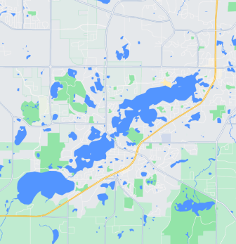
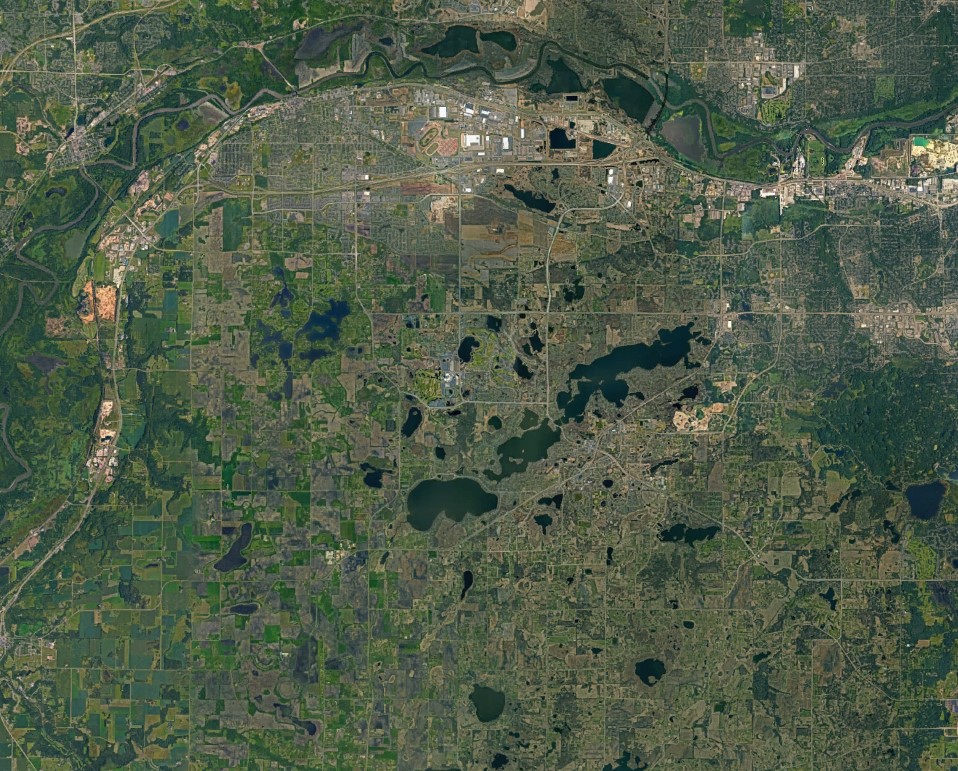
Prior Lake is impacted in a unique way by precipitation because it is the lowest natural point in its watershed—an area of land where all water drains to a common outlet. For Prior Lake, this means that all the lakes, streams, ditches, and runoff from almost 30 square miles eventually flow into it. Even after a storm ends, water continues to flow downstream into Prior Lake, which can keep its levels rising after the rain stops. It also means that Prior Lake is the last to be replenished after a drought; Spring Lake will recover entirely before any water flows through the connecting channel into Prior Lake.
Lower Prior Lake also experiences significant evaporation compared to other lakes in the watershed due to its size. With nearly 1.5 square miles of surface area, it offers ample space for evaporation, especially during warm, windy weather and in dry years. It is deeper than many other lakes in the area, so it is usually the last lake in the watershed to freeze over. These longer periods of open water in late fall and early winter provide even more time for evaporation to lower the lake elevation.
There is little to be done about low water levels, but the Prior Lake-Spring Lake Watershed District does work to mitigate flooding. One key strategy is increasing water storage throughout the watershed. Features like wetlands, rain gardens, and stormwater ponds help slow down and filter precipitation before it flows into the lakes. These measures balance the rate of which water enters the lake with what is leaving, reducing extreme fluctuations.
The only outlet for Prior Lake is the manmade Prior Lake Outlet Channel, which begins in Grainwood Bay. This channel is our “last line of defense” flood protection feature and helps to relieve water levels over 902.5 feet. While Prior Lake levels remain “bouncy” today, the graph shows what lake levels looked like before the outlet channel was created.
While we can’t control the weather, we can take steps to reduce flooding risks and protect the health of the lake for future generations.