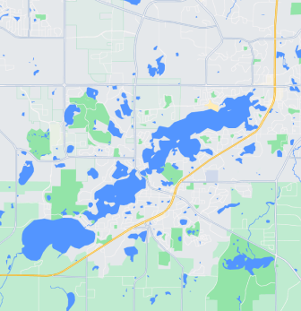
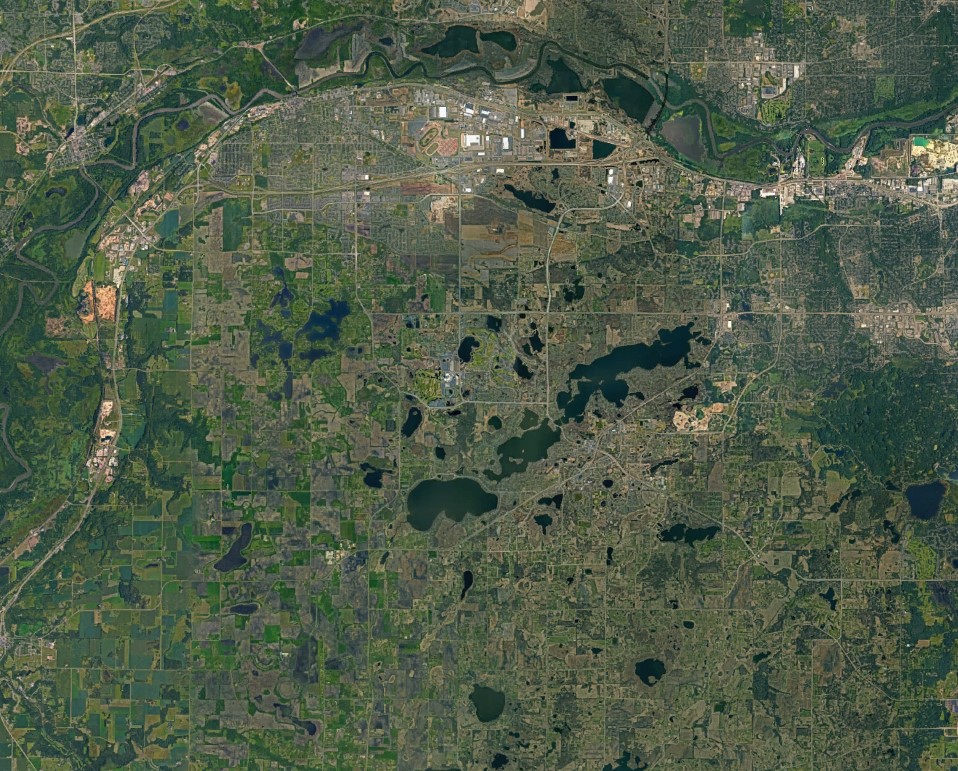

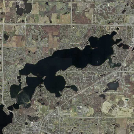
Prior Lake, Lower
DNR Lake Number: 70002600
Public Boat Access: Sand Point (off Crest Avenue on north side of lake)
Quick Facts
Surface Area
956 acres
Ordinary High Water Level*
903.9 feet above sea level
Average Depth
13 feet
Watershed Area
18,904 acres
Maximum Depth
56 feet
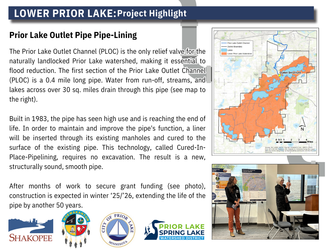
Connectivity to other waterbodies
Water flows from Upper Prior into Lower Prior. Water leaves Lower Prior through the outlet structure and travels through the Prior Lake Outlet Channel (PLOC) to the Minnesota River.
Bridge Clearance
The elevation at the bottom of Wagon Bridge (Highway 21 bridge) is approximately 911.5′. Subtract the current lake elevation from 911.5′ to get the approximate clearance.
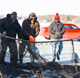
Aquatic Invasive Species
Zebra mussel, Eurasian watermilfoil, Curlyleaf pondweed, common carp, Chinese mystery snail
High Water No-Wake Restrictions
When lake level exceeds 903.9 feet*
Impairment Status
Impaired for mercury** and biota***
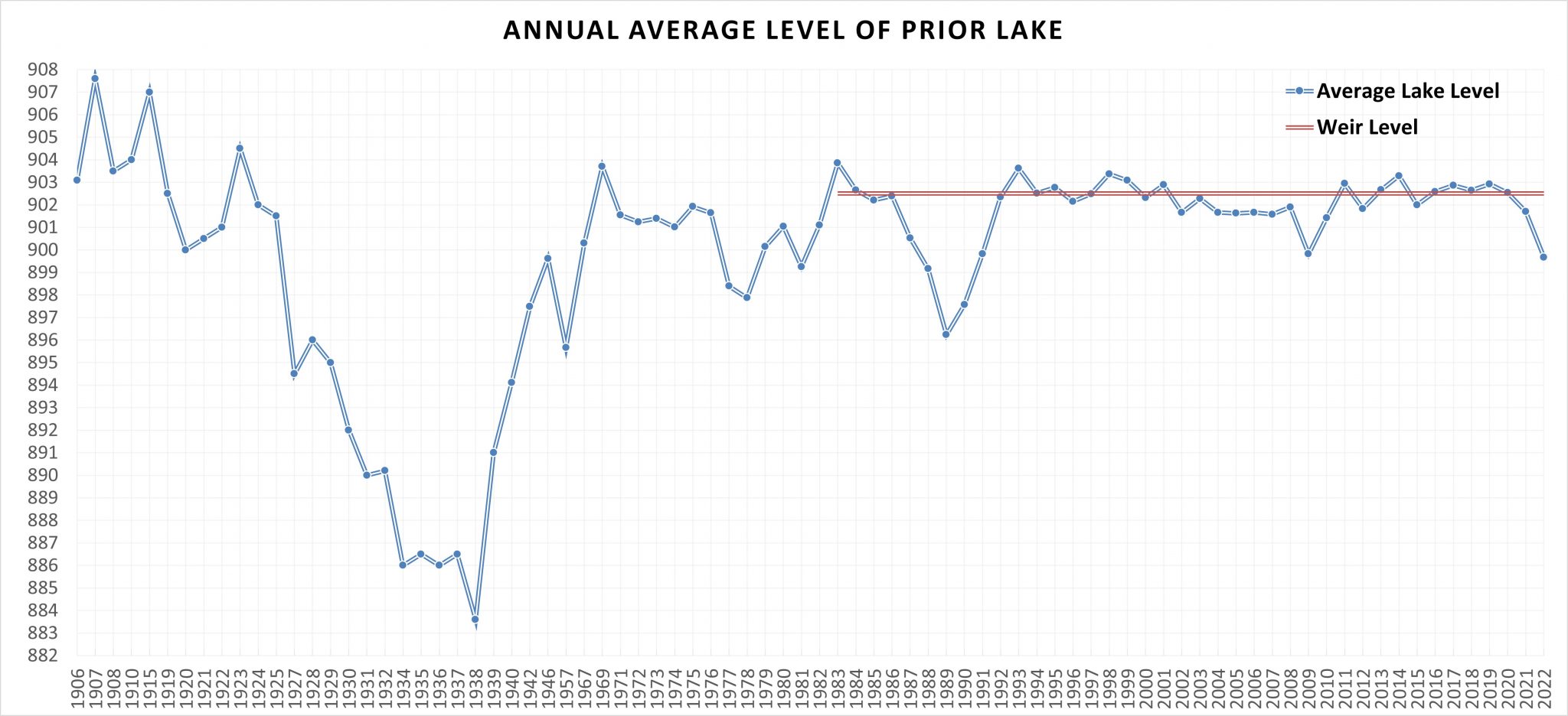
Historical Lake Levels
The graph below displays the average of annual lake level readings, when available. Some years only had one lake level measurement so those would not reflect the “average” and could have been taken at any time of year. Also, some years are missing from this graph because there is no known data available. The red line indicates when the weir was installed. Prior to the red line, there was no natural outlet for Prior Lake.
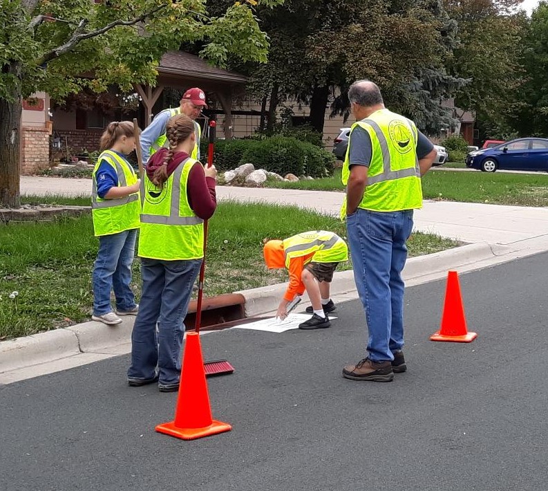
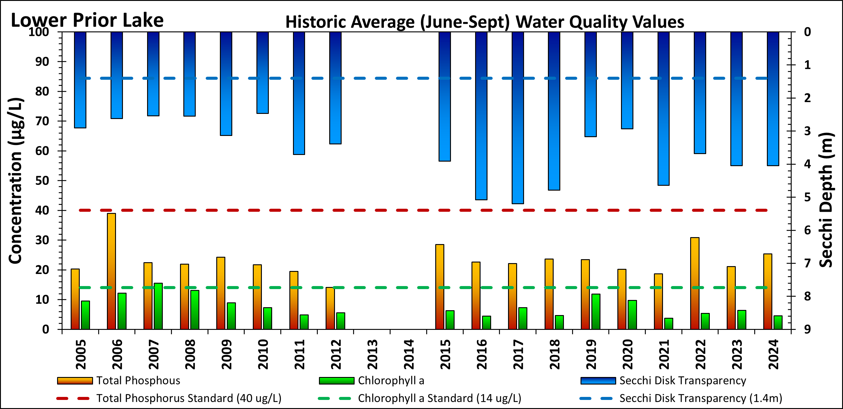
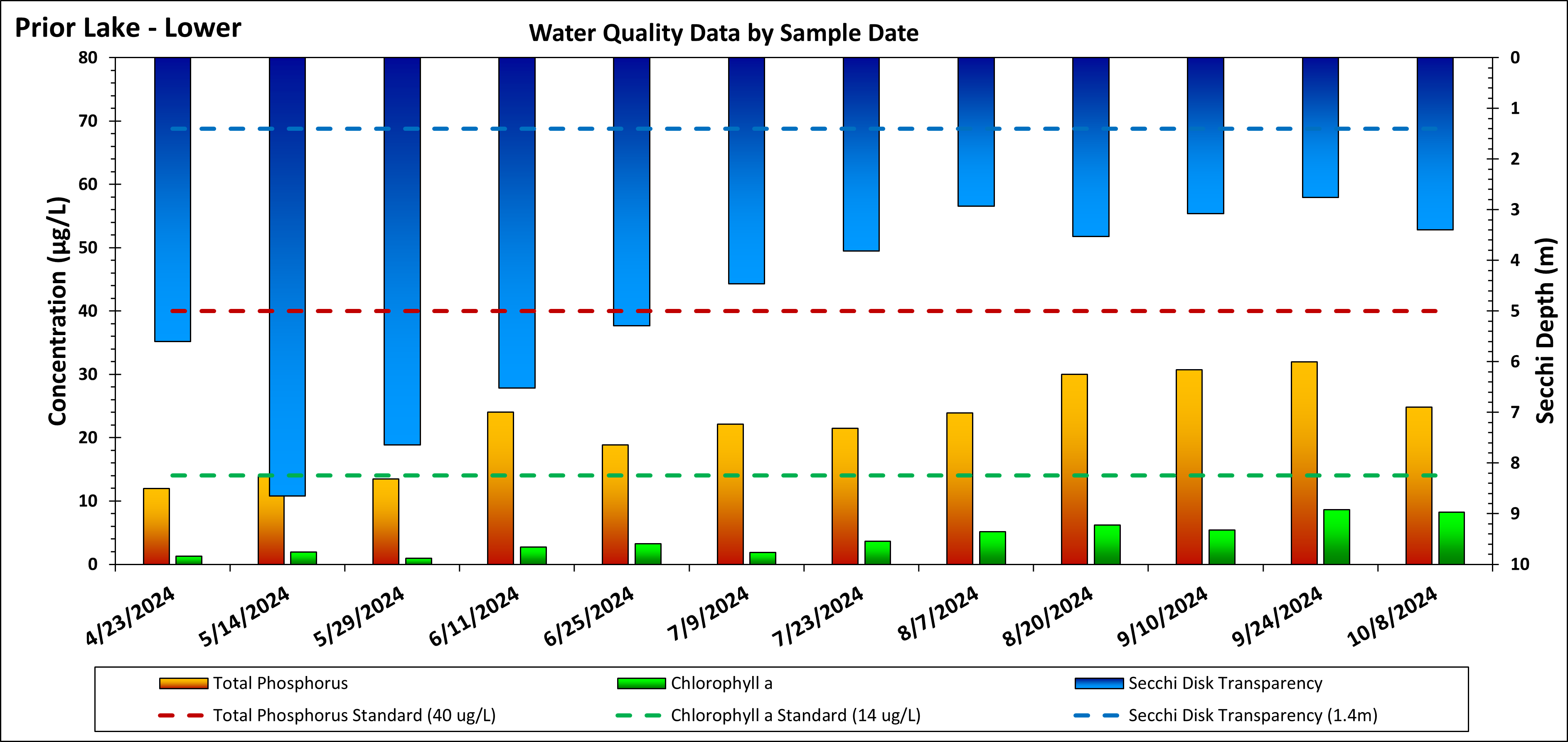
Water Quality
Click on each image below to view in a larger size
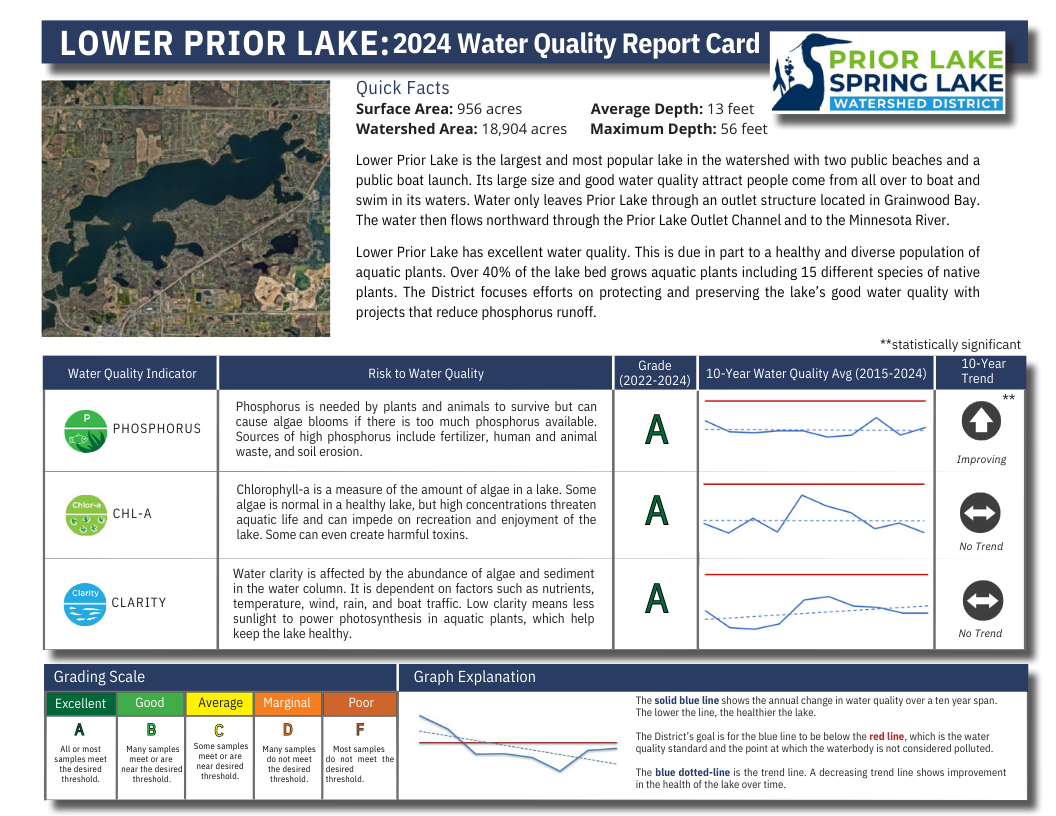
This graph represents the annual averages of water quality parameters between June 1 and September 30.
This graph show water quality parameters on specific dates in 2024.
Related Resources
Ongoing Projects
Completed Projects
*No-Wake restrictions are set by the City of Prior Lake and enforced by the Scott County Sheriff. Once high water levels have subsided and remained below the no-wake level (903.9 ft) for 72 hours, no-wake restrictions will be lifted. For more details, view the full city ordinance.
**Mercury impairments are not handled at the local government level. The State of MN has a TMDL they are following here.
***Biota impairments are not handled at the local government level. The State of MN addresses impaired biota by examining the interactions of numerous physical, chemical, and biological processes that define community composition. Biological impairments can be driven by natural or unnatural changes to one or many components of these systems. Biological impairments differ from some traditional water quality impairments in that the impaired biotic communities are indicators of disturbance rather than causes of disturbance. Biological impairments are commonly caused by stressors that are not considered conventional pollutants. These include stressors such as degraded habitat or altered hydrology. Minnesota utilizes the process of stressor identification developed by the EPA to identify the dominant stressors.