Treatment for curlyleaf pondweed (a non-native, invasive aquatic plant) on Prior Lake was completed yesterday (May 12) and Spring Lake’s treatment is scheduled for Friday (May 15). It is recommended that you wait three days after treatment to use lake water to irrigate lawns or gardens.
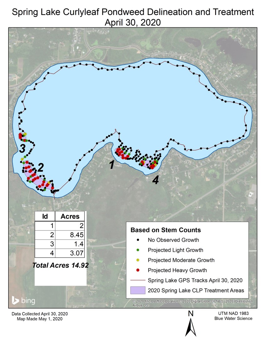
The District completed aquatic plant surveys this spring identified several areas with high concentrations of curlyleaf pondweed for treatment. Treatment areas are numbered and marked on the maps below in orange for Prior Lake and purple for Spring Lake.
Why treat? As is common with non-native, invasive species, curlyleaf pondweed is one of the first things growing in the spring. Unfortunately this gives it a head start and allows the curlyleaf to crowd out the native aquatic plants that are good for the lake. Treating the curlyleaf gives a native plants a chance to grow.